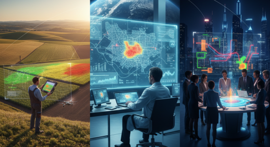
The Clear Change in Farming
In farming the change is really clear. Agriculture has always depended on knowing what’s happening in the soil, in the air, with the weather, and with pests. Before, a farmer would literally have to walk the fields and just eyeball things. If crops started looking sick or water was running low, they’d notice it maybe too late. With remote sensing the story changes. Drones or satellites can give a farmer a kind of bird’s-eye view that shows which parts of a field are thriving and which parts are stressed. And the cool part is they can see those signs weeks before they’d be obvious on the ground.
Precision Agriculture: Targeting Resources
That leads to this whole “precision agriculture” thing, where instead of throwing water and fertilizer across the whole field, the farmer can target the exact spots that need it. Saves money, saves time, and reduces waste. Imagine one corner of a farm drying out faster than the rest. Instead of overwatering everything, irrigation can be focused right there. Or if a small pest problem is spotted, chemicals don’t have to be sprayed across acres—just in the specific patch. That’s better for the farmer’s wallet and also way better for the environment. Remote sensing isn’t only for crops either. Ranchers are starting to use it to see how their cattle move and graze, so the land doesn’t get worn out. For more in-depth analysis on how this technology is being implemented, it’s worth checking out the work of consulting companies in remote sensing applications.
Creeping Into Healthcare
Healthcare sounds less obvious at first, but remote sensing is creeping in there too. Disease outbreaks often have a lot to do with environment. Mosquitos, for example, need water and warm temps, so by looking at rainfall and heat maps from satellites, scientists can guess where malaria might spread next. The same goes for tracking things like dust storms or pollution that cause breathing problems. Instead of just reacting when people start showing up at hospitals, healthcare workers can see the bigger picture ahead of time.
Even during covid remote sensing played a weird but useful role. By looking at satellite images of roads and even nighttime lights, researchers could guess how strict lockdowns were and how economies were bouncing back.
And air quality is another big one. Satellites can measure the levels of harmful stuff floating around in the air, giving cities a much better picture of what people are actually breathing in. That helps connect the dots between pollution and public health in a way that ground sensors alone can’t always manage.
Running Smoother Smart Cities
Then there’s smart cities. This idea that a city can be run more smoothly with the help of tech. Cities are messy—traffic, energy, water use, buildings, green areas, all tangled up. Remote sensing gives planners and governments an extra set of eyes. Traffic jams, for instance, can be tracked from above so traffic lights or bus routes can be adjusted. Another example is urban heat islands, those spots where the concrete and asphalt trap way more heat than nearby areas. With remote sensing, those hot zones can be mapped so trees can be planted or building materials swapped out to cool things down.
Planning and Disaster Response
Remote sensing is also handy for planning ahead. Cities are growing so fast that sometimes officials don’t even know where people are settling until problems show up. Satellite images help show land use in real time, which helps decide where new roads, schools, or housing should go. And when disasters strike—like floods, hurricanes, or earthquakes—remote sensing becomes even more critical. Instead of sending people out to guess what neighborhoods were hardest hit, updated satellite images can point to the areas most in need of help.